
Season 2008
Excavation of Karanis
The work in Karanis was conducted by trench supervisors with the help of both American and Egyptian Field School students. This season we worked in several new trenches and one trench that continued from previous years.
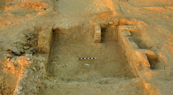
Trench KA04 is situated in the central part of the site in between Michigan's "Area G" and the North Temple. The work here was started in 2006 as a 5 x 5 m. trench and expanded in 2007 to a 7 x 6 m. trench. Trench KA04 was a court yard in between several buildings. In 2008 excavation started in a trench to the southeast of the court yard area, named KA14. This is the house connected to the court yard by a door way with a wooden threshold. The main purpose of the trench is to get a good overview of botanical and zoological materials from a domestic context.
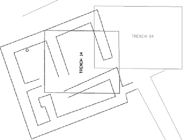
Plan of trenches KA04 (court yard) and KA14 (house).
Walls and door opening of the house in trench KA14. Note the wooden treshhold to the right leading towards the court yard (trench KA04).
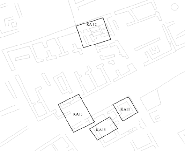
Four trenches were started in the Northeast area of the site, where no previous excavations have taken place. Excavation was slow in the trenches which were excavated by the field school students. With the exception of trench 12, no occupation level was reached. Excavations in all trenches will be continued next year.
Overview of the cluster of new trenches in the eastern part of Karanis.
Trench KA11 is a 3 x 4 meter trench in a building with painted wall plaster. After noticing that the plaster deteriorated quickly, excavation work was postponed to next year, so that a specialized conservator can join us to take the appropriate measures.
Trench KA11 looking south. The plastered wall is the one on the left.
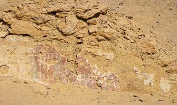
Trench KA11. Detail of painted wall plaster
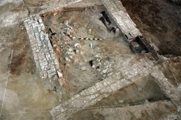
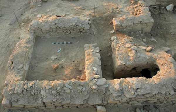
Trench KA12 is a 5 x 6 meter trench in a large building that, judging from the lay-out is one of the largest granaries to be found in Karanis. The excavation recovered a hallway and a storage bin divided in four parts, of which two were excavated completely. At the back of the hallway a trap door was found that leads to a cellar, which was closed off carefully.
Trench KA12: the granary
Trench KA13: a 5 x 7 meter trench in the street between the building in which trenches KA11 and 15 are excavated and the granary in which trench KA12 was placed. The trench shows the outside (south) wall of the granary, with several building phases, as well as a small wall built into the street to keep the rising street level from blocking the granary door.
Trench KA13: the street
Trench KA15 is a 3 x 4 meter trench in the same building, but directly southwest of trench 11. This trench had a garbage dump in the middle of the room, partly deposited there by robbers who excavated a pit in the northwest corner of the room (outside the trench).
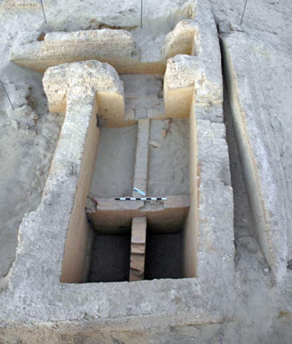
Trench KA16 is 2.5 x 4 m trench to the south of the Kom, within two parallel lines of fired bricks visible at the surface. The trench contained a section of a cistern, built in at least two phases, the first phase probably dating to the second century AD.
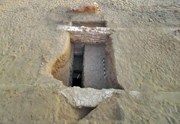
Trench KA16: the cistern
A topographical map was made of the unexcavated north-east part of the site, and the area south of the South Temple, which had been damaged by sebakhin. See Eastern Karanis and Southern Karanis.
Site management work in Karanis
Work to restore the old excavation house of Michigan University, also known as Beyt Mandub Sami Brittani, started this season. The entire building was cleared of many meters of collapsed mud brick and roofing material. Under the debris good intact floors were found. Local youths were trained in traditional building methods, and worked on replacing the roof in several sections, repairing several of the walls, and rebuilding the old storage room.
All windows to the south and east of the building have been cleaned and the glass replaced. Three panels were put up in the main court yard of the house to inform visitors of this work in progress. A routing for the site has been designed focusing on three narrative tracks, which will also be the main themes in the exhibit in the house:
1. Fayum as an ancient landscape
2. The history of Karanis
3. Development of archaeological methods and approaches
For further reading, see the restoration of the Visitor's Centre: Beyt Sobek.
Canal survey
Caton Thompson and Gardner identified nine canals, which they considered to be part of the Ptolemaic infrastructure to expand the cultivable area. The project made an effort to locate these, and do some precise elevation measurements in order to better understand the watering system.
In addition to the 15 exploratory trenches which were excavated in 2007, six more were excavated in 2008 in the canal system around the north and north-east of lake Qarun. All canals known from the 1920's were relocated, but some have been damaged or destroyed by modern construction, quarrying and agricultural activity. The canals that could be dated through associated pottery appeared to be early Roman, rather than Ptolemaic.
Survey and excavation on north shore Lake Qarun: E29H1
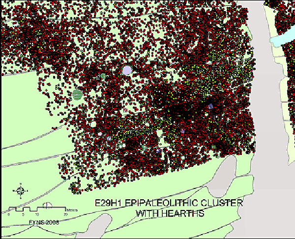
Work was originally planned to continue in Kom K. When arriving in the region, however, it appeared that another very important area, visited by Gertrude Caton Thompson in the 1920's and published by Wendorf and Schild in 1979 (reporting field work from 1969), was being destroyed by very recent agricultural development. The site is known in the literature as E29H1, and consists of an enormous and very dense surface scatter of bone and lithics, with many hearths. With kind cooperation of the land owner it was decided to put all the team's resources in this area and piece provenience the most important parts of the site.
Southern part of one of the 3 surveyed fields of E29H1
The result is a detailed GIS, which displays different clusters. Most of these can be dated to the Epi-palaeolithic, based on lithic typology. Preliminary results of the zooarcheological analysis are the occurrence of many fish species, mostly clarids, but also puffer fish, as well as a limited number of wild animals such as gazelle, hippopotamus, and hartebeest, with a dearth of wild birds.
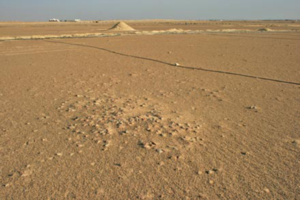
Surface with deflated hearth and agricultural disturbance (bulldozing, ditches and water lines) at E29H1.
Northwards, at a higher elevation, the surface remains show features of a Neolithic occupation, although with a dearth of pottery. Several of the bone clusters were sampled in detail, by hand picking as well as sieving the top soil. Fifty hearths were excavated, some of which still contained charcoal.
A geoarchaeological research program, which involved the study of profiles of the ditches and bulldozer scars, as well as hand auguring, identified several peninsulas and marshy areas.
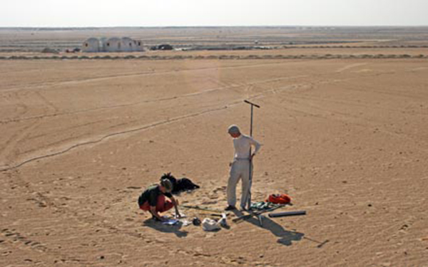
Geoarchaeological research by hand auguring at E29H1
Survey and excavation on north shore Lake Qarun: Kom W
Because the agricultural development had neared the important Neolithic settlement of Kom W at 1.4 km, and because the Kom had a large number of very recent tire tracks, it was decided to excavate two trenches to obtain vital information. It was decided that the site needed to be protected by a barbed wire fence, which was built by the URU project.
In 1924 Caton Thompson excavated twenty trenches of approximately 3 meters wide and 20 meters long across the site of Kom W. Based on a magnetic survey in 2004, and a test trench excavated in 2006, we discovered that she had left baulks of approximately 60 cm wide between these trenches. This season we laid out two trenches to excavate parts of the baulks. All the back dirt from the 1920's was sieved and checked for faunal and botanical materials, as well as lithics and pottery.
The in situ hearths in the old baulks were bulk sampled, and sieved under controlled circumstances at the site laboratory. The surrounding soil was sieved at the site on a 2 mm mesh. The baulks were heavily salt encrusted, and stood up firmly even after all the back dirt was removed. Approximately 250 m west of Kom W a hearth, one in a group of three, was excavated, to understand the diachronical occupation of the region.
Publication
The results from the 2008 season will be published shortly. A volume of the Neolithic and Epipalaeolithic work from 2003-2008 is in progress, while work in the Greco-Roman sites will be published immediately after the prehistoric volume.
See also: Trenches and supervisors in 2008.